 Catalogue PIGMA
Marine Strategy Framework Directive (MSFD)
Type of resources
Available actions
Topics
Keywords
Contact for the resource
Provided by
Formats
Representation types
Update frequencies
status
Scale
Resolution
-

The activity calendars of fishing vessels reconstituted each year provide access to the following monthly fishing data: main operating port, number of pepole on board, number of days at sea and of, trade (s) practiced ( s), exploited fishing areas and their distance from the coast. Annual data on the dimension and mesh size of the engines used to practice a trade are also provided.
-
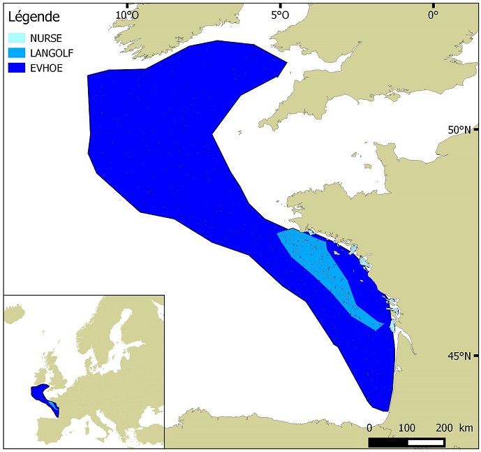
Distribution of benthic invertebrate species in Atlantic based on cumulative and interpolated relative abundance density data from fisheries surveys EVHOE (2008-2013), LANGOLF (2011-2013), NURSE (2000-2013), ORHAGO (2011-2015)
-
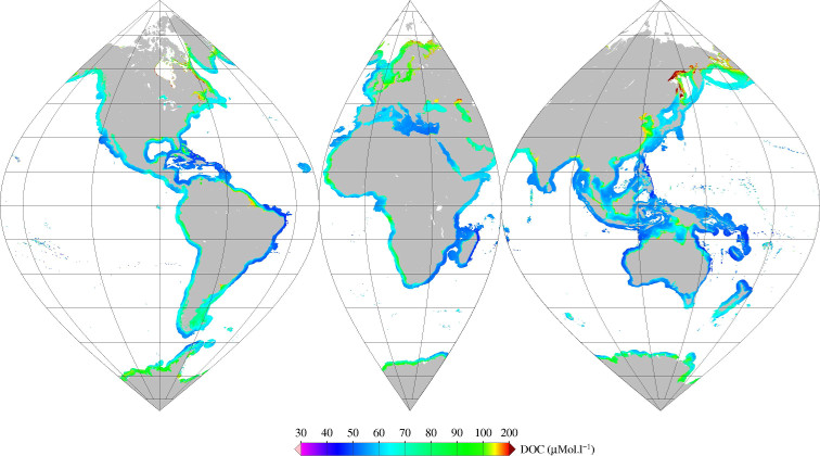
Monthly mean of Dissolved Organic Carbone (DOC) (2002-2012) for coastal areas, at global scale, for MERIS sensor, with POLYMER atmospheric corrections. Ref: V Vantrepotte, F Danhiez, H Loisel, S Ouillon, X Mériaux, A Cauvin and D Dessailly. CDOM-DOC relationship in contrasted coastalwaters: implication for DOC retrieval from ocean color remote sensing observation. OPTICS EXPRESS 33 Vol. 23, No. 1 DOI:10.1364/OE.23.000033 2015
-

-
-
"Rechargement des plages à partir de matériaux dragués" contient des données surfaciques estimées à partir des enquêtes dragage du CEREMA.
-

-
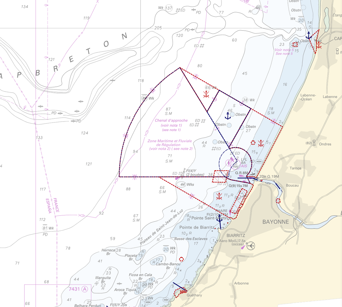
"Regulation - Navigation" product contains 18 object classes, the acronyms used are those of IHO standard S-57 - International Hydrographic Organization – (https://iho.int/): - Anchorage area (ACHARE): an area in which vessels anchor or may anchor. - Anchor berth (ACHBRT): a designated area of water where a single vessel, sea plane, etc. may anchor. - Administration Area (Named) (ADMARE) - Cable area (CBLARE) - Coastguard station (CGUSTA) - Cargo transhipment area (CTSARE) - Distance mark (DISMAR): mark indicating the distance on canals or rivers. - Dumping ground (DMPGRD): sea area where dredged material or other potentially more harmful material e.g. explosives, chemical waste, is deliberately deposited. - Fairway (FAIRWY): part of a river, harbour etc. where the main navigable channel for vessels of larger size lies. It is also the usual course followed by vessels entering or leaving harbours and sometimes called "ship channel". - Ice area (over land or water) (ICEARE) - Local magnetic anomaly (LOCMAG): anomaly of the magnetic field of the earth, extending over a relatively small area, due to local magnetic influences. - Marine farm/culture (MARCUL) - Navigation line (NAVLNE): a line generally passing through two clearly defined charted landmarks, and along part of which a vessel can approach safely. - Pipeline area (PIPARE) - Recommended track (RECTRC): track of undefined width, recommended to all or only certain vessels. - Restricted area (RESARE): specified area designated by an appropriate authority within which navigation is restricted in accordance with certain specified conditions. - Sea-plane landing area (SPLARE) Detailed definitions of each of these object classes can be found in the S-57 standard (https://iho.int/en/standards-and-specifications). An online catalog is available at http://www.s-57.com/. Some of the symbols used for display on data.shom.fr portal have been adapted from icons from the OpenSeaMap open library (https://github.com/OpenNauticalChart/). For reasons of readability, not all the characteristics of the objects are systematically displayed. All available information can be consulted by querying this layer.
-
-
The dataset includes age- and length-based catch per unit effort data for commercial fish species collected by the French trawl survey EVHOE.